
Puy Mary topographic map
Interactive map
Click on the map to display elevation.
About this map
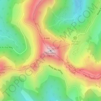
Name: Puy Mary topographic map, elevation, terrain.
Average elevation: 4,636 ft
Minimum elevation: 3,727 ft
Maximum elevation: 5,781 ft
De Puy Mary is een van de hoogste bergen in het Cantalgebergte in het Centraal Massief. De top bevindt zich op een hoogte van 1783 meter in de gemeente Le Claux. De berg heeft een vulkanische oorsprong.