
Almoster topographic map
Interactive map
Click on the map to display elevation.
About this map
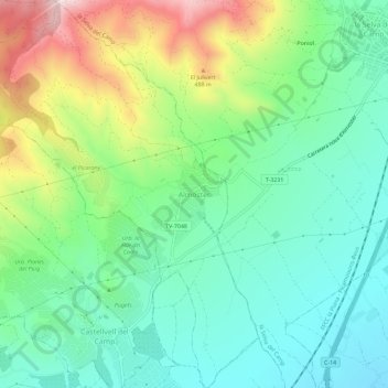
Name: Almoster topographic map, elevation, terrain.
Location: Almoster, Baix Camp, Tarragona, Catalunha, 43393, Espanha (41.17447 1.07477 41.21778 1.12073)
Average elevation: 958 ft
Minimum elevation: 440 ft
Maximum elevation: 2,083 ft
Other topographic maps
Click on a map to view its topography, its elevation and its terrain.