
Kalaklan topographic map
Interactive map
Click on the map to display elevation.
About this map
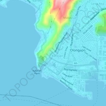
Name: Kalaklan topographic map, elevation, terrain.
Location: Kalaklan, Zambales, Central Luzon, 222, Philippines (14.80942 120.25162 14.84942 120.29162)
Average elevation: 49 ft
Minimum elevation: -3 ft
Maximum elevation: 745 ft