
Umeå topographic map
Interactive map
Click on the map to display elevation.
About this map
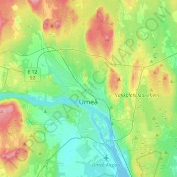
Name: Umeå topographic map, elevation, terrain.
Location: Umeå, Umeå kommun, Västerbottens län, Norrland, Svezia (63.78556 20.13384 63.88203 20.38535)
Average elevation: 108 ft
Minimum elevation: -16 ft
Maximum elevation: 322 ft