
Presa del Pantà de Siurana topographic map
Interactive map
Click on the map to display elevation.
About this map
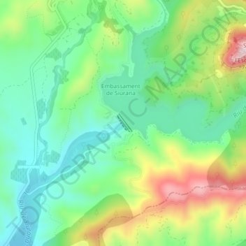
Name: Presa del Pantà de Siurana topographic map, elevation, terrain.
Average elevation: 1,680 ft
Minimum elevation: 1,309 ft
Maximum elevation: 2,388 ft
Other topographic maps
Click on a map to view its topography, its elevation and its terrain.
Cornudella de Montsant
España > Cataluña > Priorato > Cornudella de Montsant > Cornudella de Montsant
Cornudella de Montsant, Priorato, Tarragona, Cataluña, 43360, España
Average elevation: 1,916 ft