Geolocate

Red Feather Lakes topographic map

Click on the map to display elevation.

About this map

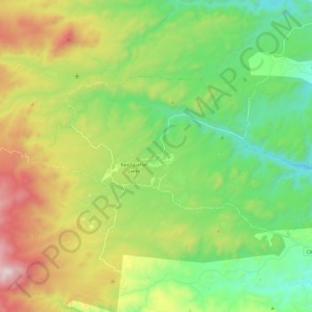
Name: Red Feather Lakes topographic map, elevation, terrain.

Location: Red Feather Lakes, Larimer County, Colorado, United States (40.76336 -105.66816 40.85211 -105.44278)

Average elevation: 8,369 ft

Minimum elevation: 7,011 ft

Maximum elevation: 10,883 ft

Larimer County trails, hiking, mountain biking, running and outdoor activities

Gear up for your next adventure:

🗺️Topographic Maps - Detailed topo maps for hiking, exploring and outdoor navigation
🥾Hiking Shoes - Durable and comfortable shoes for trail hiking
🏔️Mountain Trail Maps - High‑detail maps for popular peaks
🧥Waterproof Jacket for Hiking - Breathable and rugged rain jacket for outdoor excursions
🛌Ultralight Sleeping Bags - Compact down bags for cold nights in the wilderness

As an Amazon Associate, this site earns from qualifying purchases at no extra cost to you.