
庐山市 topographic map
Interactive map
Click on the map to display elevation.
About this map
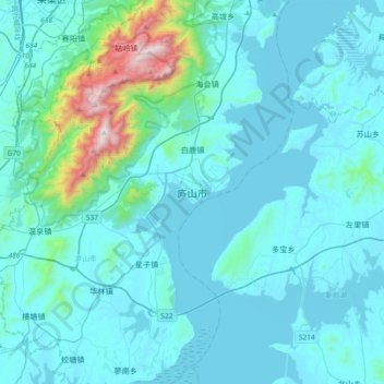
Name: 庐山市 topographic map, elevation, terrain.
Location: 庐山市, 南康镇, 庐山市, 九江市, 江西省, 中国 (29.29059 115.87966 29.61059 116.19966)
Average elevation: 463 ft
Minimum elevation: 20 ft
Maximum elevation: 4,734 ft
境内西北多山峰、丘陵, 海拔千米以上的山峰有18座。其中境内庐山主峰汉阳峰最高,海拔1473.4米。以汉阳峰为中心, 群峰环绕。