
Kamakura topographic map
Interactive map
Click on the map to display elevation.
About this map
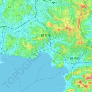
Name: Kamakura topographic map, elevation, terrain.
Location: Kamakura, Prefectura de Kanagawa, Japón (35.26656 139.48855 35.36822 139.59317)
Average elevation: 108 ft
Minimum elevation: -3 ft
Maximum elevation: 659 ft