
Aarschot topographic map
Interactive map
Click on the map to display elevation.
About this map
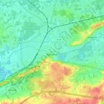
Name: Aarschot topographic map, elevation, terrain.
Location: Aarschot, Leuven, Flemish Brabant, Flanders, Belgium (50.95810 4.80040 51.01310 4.87061)
Average elevation: 85 ft
Minimum elevation: 13 ft
Maximum elevation: 230 ft
Other topographic maps
Click on a map to view its topography, its elevation and its terrain.
Ourodenberg
Belgium > Flemish Brabant > Leuven > Aarschot
Ourodenberg, Aarschot, Leuven, Flemish Brabant, 3200, Belgium
Average elevation: 52 ft