
Meesapulimala topographic map
Interactive map
Click on the map to display elevation.
About this map
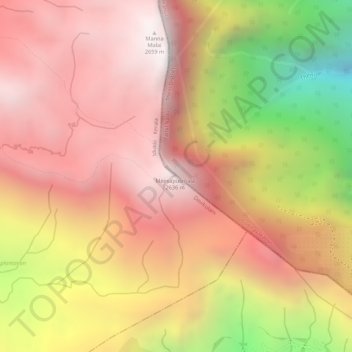
Name: Meesapulimala topographic map, elevation, terrain.
Location: Meesapulimala, Idukki, Kerala, 685618, India (10.08737 77.20448 10.08747 77.20458)
Average elevation: 7,287 ft
Minimum elevation: 4,656 ft
Maximum elevation: 8,671 ft
Other topographic maps
Click on a map to view its topography, its elevation and its terrain.
chithirapuram
chithirapuram, Devikulam, Idukki, Kerala, India
Average elevation: 3,084 ft
Pond at Kesavan Purayidom, Kanjikuzhy
Pond at Kesavan Purayidom, Kanjikuzhy, Idukki, Kerala, India
Average elevation: 2,096 ft
Western Ghats
Western Ghats, Idukki, Kerala, 685614, India
Average elevation: 7,300 ft