
Ponente topographic map
Interactive map
Click on the map to display elevation.
About this map
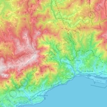
Name: Ponente topographic map, elevation, terrain.
Location: Ponente, Genova, GE, LIG, Italia (44.41294 8.66574 44.49903 8.85764)
Average elevation: 1,512 ft
Minimum elevation: 0 ft
Maximum elevation: 3,858 ft
Other topographic maps
Click on a map to view its topography, its elevation and its terrain.