Geolocate

Baralla topographic map

Click on the map to display elevation.

About this map
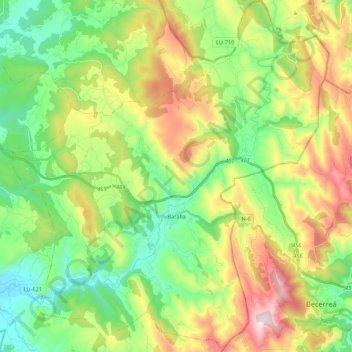
Name: Baralla topographic map, elevation, terrain.

Location: Baralla, Os Ancares, Lugo, Galicia, Spain (42.83296 -7.35078 42.99022 -7.15711)

Average elevation: 2,136 ft

Minimum elevation: 1,312 ft

Maximum elevation: 3,839 ft

Other topographic maps

Click on a map to view its topography, its elevation and its terrain.
Ferreiras

Spain > Galicia > Os Ancares > As Nogais

Average elevation: 3,363 ft

Gear up for your next adventure:

📷Action Cameras - Rugged cameras to document your journeys across rugged terrain
💧Water Purification System - Clean water on the trail with reliable purifiers
🛶Inflatable Kayak - Portable kayak for rivers, lakes, and expeditions
🧭Outdoor Navigation Book - Learn advanced navigation skills
🪶Fire Starter Kit - Reliable fire starter for survival and camping

As an Amazon Associate, this site earns from qualifying purchases at no extra cost to you.