
Kengoma topographic map
Interactive map
Click on the map to display elevation.
About this map
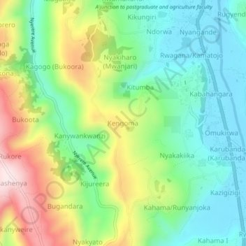
Name: Kengoma topographic map, elevation, terrain.
Location: Kengoma, Kabale, Western Region, Ouganda (-1.30920 29.96050 -1.26920 30.00050)
Average elevation: 6,417 ft
Minimum elevation: 5,873 ft
Maximum elevation: 7,428 ft