
Marchwood topographic map
Interactive map
Click on the map to display elevation.
About this map
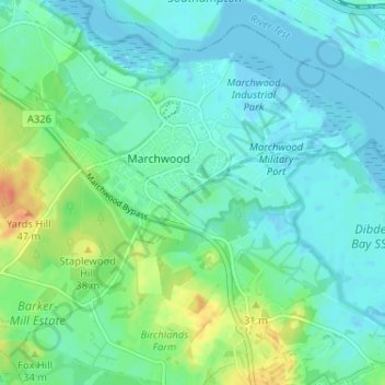
Name: Marchwood topographic map, elevation, terrain.
Location: Marchwood, New Forest, Hampshire, England, United Kingdom (50.86979 -1.47781 50.90570 -1.41331)
Average elevation: 36 ft
Minimum elevation: -13 ft
Maximum elevation: 131 ft