
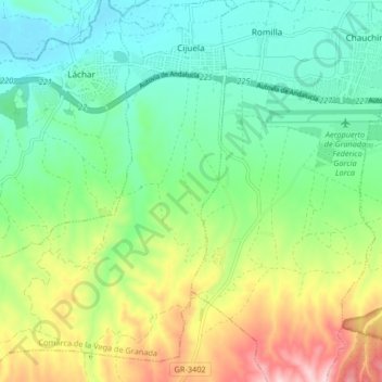
Cijuela topographic map
Interactive map
Click on the map to display elevation.
About this map
Name: Cijuela topographic map, elevation, terrain.
Average elevation: 1,982 ft
Minimum elevation: 1,706 ft
Maximum elevation: 2,546 ft
Other topographic maps
Click on a map to view its topography, its elevation and its terrain.
Maracena
España > Andalucía > Comarca de la Vega de Granada
Maracena, Comarca de la Vega de Granada, Granada, Andalucía, 18200, España
Average elevation: 2,169 ft