
Petiton topographic map
Interactive map
Click on the map to display elevation.
About this map
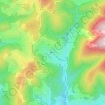
Name: Petiton topographic map, elevation, terrain.
Average elevation: 1,745 ft
Minimum elevation: 1,148 ft
Maximum elevation: 2,618 ft
Other topographic maps
Click on a map to view its topography, its elevation and its terrain.
Les Bourbas
France > Bourgogne-Franche-Comté > Nièvre > Villapourçon
Les Bourbas, Villapourçon, Château-Chinon (Ville), Nièvre, Bourgogne-Franche-Comté, France métropolitaine, 58370, France
Average elevation: 1,467 ft
La Pompie
France > Bourgogne-Franche-Comté > Nièvre > Villapourçon > Avaux
La Pompie, Avaux, Villapourçon, Château-Chinon (Ville), Nièvre, Bourgogne-Franche-Comté, France métropolitaine, 58370, France
Average elevation: 1,578 ft