
Île de l'Est topographic map
Interactive map
Click on the map to display elevation.
About this map
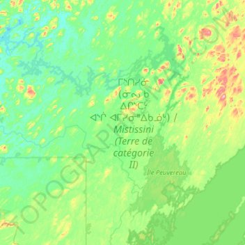
Name: Île de l'Est topographic map, elevation, terrain.
Location: Île de l'Est, Eeyou Istchee, Nord-du-Québec, Quebec, Canada (50.93491 -74.27314 51.57491 -73.63314)
Average elevation: 1,237 ft
Minimum elevation: 1,050 ft
Maximum elevation: 2,244 ft