
Plessa topographic map
Interactive map
Click on the map to display elevation.
About this map
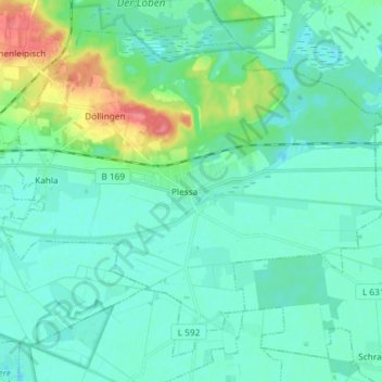
Name: Plessa topographic map, elevation, terrain.
Location: Plessa, Elbe-Elster, Brandebourg, 04928, Allemagne (51.42453 13.54985 51.50370 13.69632)
Average elevation: 325 ft
Minimum elevation: 282 ft
Maximum elevation: 495 ft