
Myerstown topographic map
Interactive map
Click on the map to display elevation.
About this map
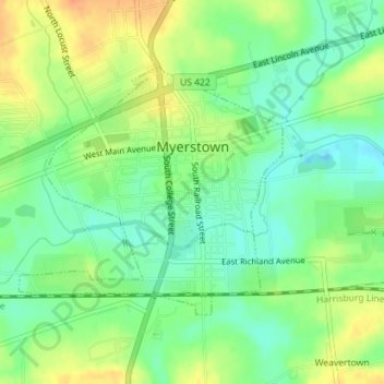
Name: Myerstown topographic map, elevation, terrain.
Location: Myerstown, Lebanon County, Pennsylvania, USA (40.36332 -76.31968 40.38087 -76.29506)
Average elevation: 482 ft
Minimum elevation: 420 ft
Maximum elevation: 558 ft