
Bum La topographic map
Interactive map
Click on the map to display elevation.
About this map
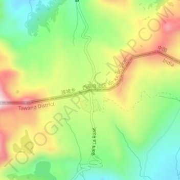
Name: Bum La topographic map, elevation, terrain.
Average elevation: 14,711 ft
Minimum elevation: 14,101 ft
Maximum elevation: 15,486 ft
Other topographic maps
Click on a map to view its topography, its elevation and its terrain.
Tawang
India > Arunachal Pradesh > Tawang Circle
Tawang, Tawang Circle, Tawang District, Arunachal Pradesh, India
Average elevation: 10,761 ft