
Leiden topographic map
Click on the map to display elevation.
About this map
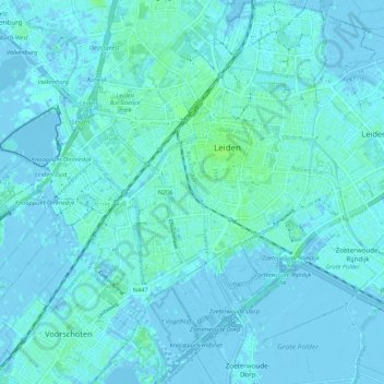
Name: Leiden topographic map, elevation, terrain.
Location: Leiden, South Holland, Netherlands (52.11895 4.43887 52.18463 4.52407)
Average elevation: 3 ft
Minimum elevation: -16 ft
Maximum elevation: 23 ft
Other topographic maps
Click on a map to view its topography, its elevation and its terrain.
Capelle aan den IJssel
Netherlands > South Holland > Capelle aan den IJssel
Dutch Topographic map of the municipality of Capelle aan den IJssel, June 2015.
Average elevation: -3 ft