
El Ángel topographic map
Interactive map
Click on the map to display elevation.
About this map
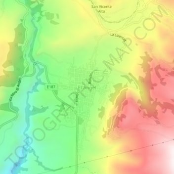
Name: El Ángel topographic map, elevation, terrain.
Location: El Ángel, El Angel, Espejo, Carchi, Ecuador (0.60125 -77.95954 0.64125 -77.91954)
Average elevation: 10,138 ft
Minimum elevation: 8,806 ft
Maximum elevation: 11,644 ft
Other topographic maps
Click on a map to view its topography, its elevation and its terrain.
Chiles
Ecuador > Carchi > Espejo > La Libertad
Chiles, La Libertad, Espejo, Carchi, Ecuador
Average elevation: 13,169 ft