
Rietberg topographic map
Interactive map
Click on the map to display elevation.
About this map
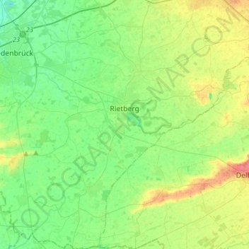
Name: Rietberg topographic map, elevation, terrain.
Average elevation: 269 ft
Minimum elevation: 213 ft
Maximum elevation: 377 ft
Other topographic maps
Click on a map to view its topography, its elevation and its terrain.
Verl
Germany > North Rhine-Westphalia > Kreis Gütersloh > Verl
Verl, Kreis Gütersloh, North Rhine-Westphalia, 33415, Germany
Average elevation: 305 ft