Geolocate

Binaton topographic map

Click on the map to display elevation.

About this map

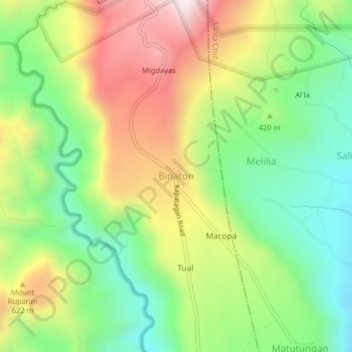
Name: Binaton topographic map, elevation, terrain.

Location: Binaton, Digos, Davao del Sur, Davao Region, 8002, Philippines (6.81790 125.33204 6.85790 125.37204)

Average elevation: 1,381 ft

Minimum elevation: 390 ft

Maximum elevation: 2,746 ft

Gear up for your next adventure:

🗺️Topographic Maps - Detailed topo maps for hiking, exploring and outdoor navigation
🪵Folding Camp Saw - Compact saw for wood and campsite work
🔥Plasma Lighters - Windproof lighters that work in any weather condition
🔌USB Car Charger - Car charger for on‑the‑go power needs
👓Polarized Sunglasses - Outdoor sunglasses for glare reduction

As an Amazon Associate, this site earns from qualifying purchases at no extra cost to you.