
Tacuati topographic map
Interactive map
Click on the map to display elevation.
About this map
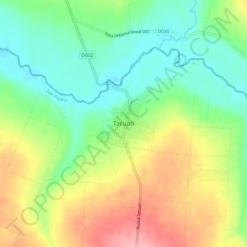
Name: Tacuati topographic map, elevation, terrain.
Location: Tacuati, San Pedro, Región Oriental, Paraguay (-23.49726 -56.77845 -23.41726 -56.69845)
Average elevation: 486 ft
Minimum elevation: 335 ft
Maximum elevation: 728 ft