
Mawlong topographic map
Interactive map
Click on the map to display elevation.
About this map
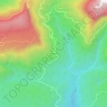
Name: Mawlong topographic map, elevation, terrain.
Average elevation: 1,542 ft
Minimum elevation: 282 ft
Maximum elevation: 3,704 ft
Other topographic maps
Click on a map to view its topography, its elevation and its terrain.
Cherrapunji (Sohra)
India > Meghalaya > Shella Bholaganj > Cherrapunji (Sohra)
Cherrapunji (Sohra), Shella Bholaganj, East Khasi Hills, Meghalaya, 793108, India
Average elevation: 4,094 ft