
Copeland Island topographic map
Interactive map
Click on the map to display elevation.
About this map
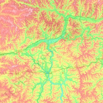
Name: Copeland Island topographic map, elevation, terrain.
Location: Copeland Island, Muskingum County, Ohio, 43701:43821, USA (39.75562 -82.30208 40.39562 -81.66208)
Average elevation: 938 ft
Minimum elevation: 666 ft
Maximum elevation: 1,260 ft
Other topographic maps
Click on a map to view its topography, its elevation and its terrain.
New Harrisburg
USA > Ohio > New Harrisburg
New Harrisburg, Harrison Township, Carroll County, Ohio, USA
Average elevation: 1,161 ft
Burton Lake
USA > Ohio > Burton Lake
Burton Lake, Burton Township, Geauga County, Ohio, 44021, USA
Average elevation: 1,142 ft