
Greensboro topographic map
Interactive map
Click on the map to display elevation.
About this map
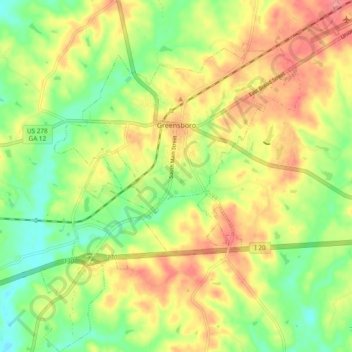
Name: Greensboro topographic map, elevation, terrain.
Location: Greensboro, Greene County, Georgia, United States (33.52492 -83.21894 33.60358 -83.13805)
Average elevation: 577 ft
Minimum elevation: 449 ft
Maximum elevation: 712 ft
Other topographic maps
Click on a map to view its topography, its elevation and its terrain.
Lake Oconee
United States > Georgia > Greene County > Lake Oconee
Lake Oconee, Greene County, Georgia, United States
Average elevation: 541 ft
White Plains
United States > Georgia > Greene County
White Plains, Greene County, Georgia, United States
Average elevation: 633 ft