
Thank you for supporting this site ❤️
Make a donation
Make a donation
Gear up for your next adventure:
As an Amazon Associate, this site earns from qualifying purchases at no extra cost to you.
Di Linh topographic map
Click on the map to display elevation.
Thank you for supporting this site ❤️
Make a donation
Make a donation
Gear up for your next adventure:
As an Amazon Associate, this site earns from qualifying purchases at no extra cost to you.
About this map
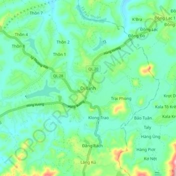
Name: Di Linh topographic map, elevation, terrain.
Location: Di Linh, Xã Di Linh, Lâm Đồng Province, Vietnam (11.54165 108.03633 11.62165 108.11633)
Average elevation: 3,140 ft
Minimum elevation: 2,953 ft
Maximum elevation: 3,766 ft
Thank you for supporting this site ❤️
Make a donation
Make a donation
Gear up for your next adventure:
As an Amazon Associate, this site earns from qualifying purchases at no extra cost to you.