Geolocate

Jedburgh topographic map

Click on the map to display elevation.

About this map

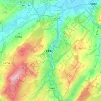
Name: Jedburgh topographic map, elevation, terrain.

Location: Jedburgh, Scottish Borders, Scotland, TD8 6AP, United Kingdom (55.43764 -2.59538 55.51764 -2.51538)

Average elevation: 495 ft

Minimum elevation: 164 ft

Maximum elevation: 1,109 ft

Gear up for your next adventure:

🔋Rechargeable Batteries - Power up your outdoor devices
Solar GPS Watches - Advanced multisport watches with built-in topographic maps
🌄Hiking Binoculars - Compact binoculars for scenic views and trail spotting
👟Men's Trail Runners - Lightweight footwear for fast-paced exploration and light hiking
Camping Coffee Makers - Enjoy premium coffee at the summit or campsite

As an Amazon Associate, this site earns from qualifying purchases at no extra cost to you.