
Sennwald topographic map
Interactive map
Click on the map to display elevation.
About this map
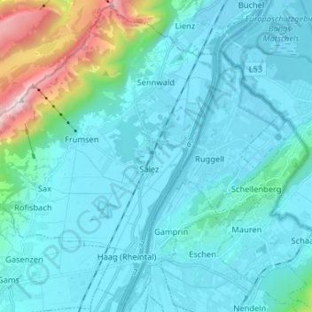
Name: Sennwald topographic map, elevation, terrain.
Location: Sennwald, Wahlkreis Werdenberg, Saint-Gall, Suisse (47.19794 9.40012 47.28302 9.53038)
Average elevation: 2,018 ft
Minimum elevation: 1,381 ft
Maximum elevation: 6,332 ft