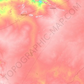
Khâi-Ma Ward 4 topographic map
Interactive map
Click on the map to display elevation.
About this map
Name: Khâi-Ma Ward 4 topographic map, elevation, terrain.
Average elevation: 3,094 ft
Minimum elevation: 1,519 ft
Maximum elevation: 3,930 ft

Click on the map to display elevation.
Name: Khâi-Ma Ward 4 topographic map, elevation, terrain.
Average elevation: 3,094 ft
Minimum elevation: 1,519 ft
Maximum elevation: 3,930 ft