
Ville Close topographic map
Interactive map
Click on the map to display elevation.
About this map
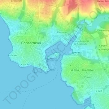
Name: Ville Close topographic map, elevation, terrain.
Average elevation: 49 ft
Minimum elevation: 0 ft
Maximum elevation: 197 ft
Other topographic maps
Click on a map to view its topography, its elevation and its terrain.
Château de Kériolet
France > Bretagne > Concarneau
Château de Kériolet, Chemin de Keriolet, Keroter, Keriolet, Concarneau, Quimper, Finistère, Bretagne, France métropolitaine, 29900, France
Average elevation: 148 ft