Geolocate

Ocean View topographic map

Click on the map to display elevation.

About this map

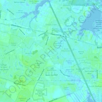
Name: Ocean View topographic map, elevation, terrain.

Location: Ocean View, Sussex County, Delaware, 19770, United States (38.51505 -75.12335 38.55777 -75.06835)

Average elevation: 13 ft

Minimum elevation: -16 ft

Maximum elevation: 33 ft

Sussex County trails, hiking, mountain biking, running and outdoor activities

Other topographic maps

Click on a map to view its topography, its elevation and its terrain.

Pilottown

United States > Delaware > Sussex County > Lewes

Average elevation: 7 ft

Lewes Beach

United States > Delaware > Sussex County > Lewes

Average elevation: 3 ft

West Rehoboth

United States > Delaware > Sussex County

Average elevation: 23 ft

Broad Meadows

United States > Delaware > Sussex County

Average elevation: 26 ft

Ceder Creek

United States > Delaware > Sussex County

Average elevation: 16 ft

Brown Street

United States > Delaware > Sussex County

Average elevation: 23 ft

Oak Drive

United States > Delaware > Sussex County

Average elevation: 30 ft

Green Hill

United States > Delaware > Sussex County > Lewes

Average elevation: 3 ft

Bayville

United States > Delaware > Sussex County

Average elevation: 3 ft

Gumboro

United States > Delaware > Sussex County

Average elevation: 43 ft

Pepperbox

United States > Delaware > Sussex County

Average elevation: 49 ft

Broad Creek

United States > Delaware > Sussex County

Average elevation: 39 ft

Bethel

United States > Delaware > Sussex County

Average elevation: 26 ft

Byewood Manor

United States > Delaware > Sussex County

Average elevation: 13 ft

Hardscrabble

United States > Delaware > Sussex County

Average elevation: 46 ft

Pilottown

United States > Delaware > Sussex County > Lewes

Average elevation: 7 ft

Gravel Hill

United States > Delaware > Sussex County

Average elevation: 43 ft

Reliance

United States > Delaware > Sussex County > Reliance

Average elevation: 43 ft

Gear up for your next adventure:

🔋Solar Power Banks - Keep your GPS and phone charged in remote wilderness areas
🥩Freeze-Dried Meals - Nutritious and lightweight food for remote expeditions
🗺️NatGeo Topo Maps - High-quality waterproof printed topographic maps of US Parks
🚁Photography Drones - Capture stunning aerial views of landforms and topography
🪶Compact Camp Shovel - Folding shovel for campsite tasks

As an Amazon Associate, this site earns from qualifying purchases at no extra cost to you.