
Kesra topographic map
Interactive map
Click on the map to display elevation.
About this map
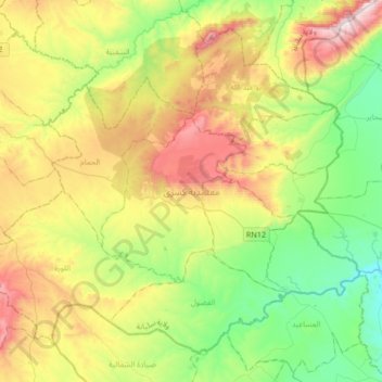
Name: Kesra topographic map, elevation, terrain.
Location: Kesra, Siliana, Tunisie (35.68792 9.20449 35.91734 9.53758)
Average elevation: 2,421 ft
Minimum elevation: 1,240 ft
Maximum elevation: 4,409 ft
Other topographic maps
Click on a map to view its topography, its elevation and its terrain.