
Hélécine topographic map
Interactive map
Click on the map to display elevation.
About this map
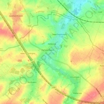
Name: Hélécine topographic map, elevation, terrain.
Location: Hélécine, Waals-Brabant, Wallonië, 1357, België (50.72365 4.92555 50.76980 5.02049)
Average elevation: 236 ft
Minimum elevation: 135 ft
Maximum elevation: 335 ft
Hélécine (Nederlands: Heylissem of soms gespeld als Heilissem) is een gemeente in de provincie Waals-Brabant in België. De gemeente telt ruim 3000 inwoners en ligt op een hoogte van 61 meter.