
Korntal-Münchingen topographic map
Interactive map
Click on the map to display elevation.
About this map
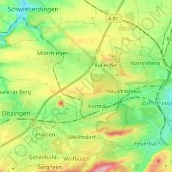
Name: Korntal-Münchingen topographic map, elevation, terrain.
Average elevation: 1,043 ft
Minimum elevation: 830 ft
Maximum elevation: 1,391 ft
Korntal-Münchingen liegt im Strohgäu in 285 bis 405 Meter Höhe nordwestlich der Landeshauptstadt Stuttgart und grenzt direkt an diese.