Daniel Hernández topographic map
Interactive map
Click on the map to display elevation.
About this map
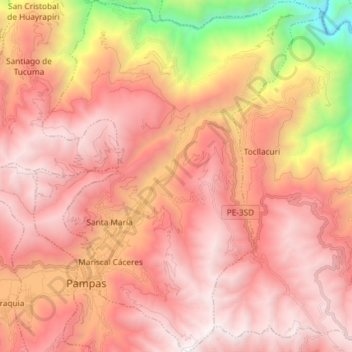
Name: Daniel Hernández topographic map, elevation, terrain.
Average elevation: 11,207 ft
Minimum elevation: 4,541 ft
Maximum elevation: 14,777 ft

Click on the map to display elevation.
Name: Daniel Hernández topographic map, elevation, terrain.
Average elevation: 11,207 ft
Minimum elevation: 4,541 ft
Maximum elevation: 14,777 ft