
Llyn Dinas topographic map
Interactive map
Click on the map to display elevation.
About this map
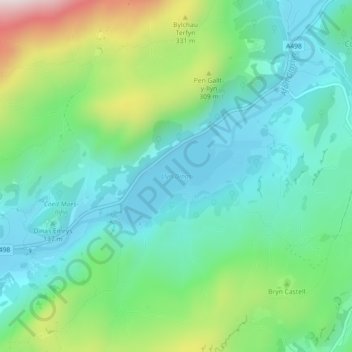
Name: Llyn Dinas topographic map, elevation, terrain.
Average elevation: 600 ft
Minimum elevation: 164 ft
Maximum elevation: 1,752 ft
Other topographic maps
Click on a map to view its topography, its elevation and its terrain.
Beddgelert
United Kingdom > Wales > Beddgelert
Beddgelert, Gwynedd, Wales, LL55 4YA, United Kingdom
Average elevation: 653 ft