
's-Heerenbroek topographic map
Interactive map
Click on the map to display elevation.
About this map
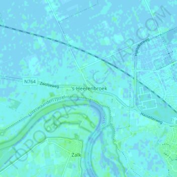
Name: 's-Heerenbroek topographic map, elevation, terrain.
Location: 's-Heerenbroek, Kampen, Overijssel, Nederland, 8275, Nederland (52.51534 5.99482 52.55534 6.03482)
Average elevation: 3 ft
Minimum elevation: -13 ft
Maximum elevation: 20 ft