
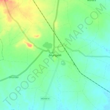
Mungaoli topographic map
Interactive map
Click on the map to display elevation.
About this map
Name: Mungaoli topographic map, elevation, terrain.
Average elevation: 1,332 ft
Minimum elevation: 1,263 ft
Maximum elevation: 1,496 ft
Other topographic maps
Click on a map to view its topography, its elevation and its terrain.
Barwah
India > Madhya Pradesh > Mungaoli Tahsil
Barwah, Mungaoli Tahsil, Ashoknagar District, Madhya Pradesh, India
Average elevation: 1,332 ft