
Meymac topographic map
Interactive map
Click on the map to display elevation.
About this map
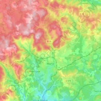
Name: Meymac topographic map, elevation, terrain.
Average elevation: 2,503 ft
Minimum elevation: 1,916 ft
Maximum elevation: 3,219 ft
Other topographic maps
Click on a map to view its topography, its elevation and its terrain.
Lontrade
Frankrijk > Nieuw-Aquitanië > Corrèze > Meymac
Lontrade, Meymac, Ussel, Corrèze, Nieuw-Aquitanië, Metropolitaans Frankrijk, 19250, Frankrijk
Average elevation: 2,864 ft