
Louisville topographic map
Interactive map
Click on the map to display elevation.
About this map
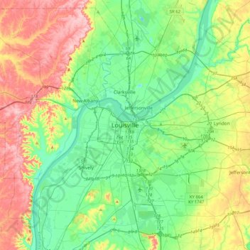
Name: Louisville topographic map, elevation, terrain.
Average elevation: 591 ft
Minimum elevation: 371 ft
Maximum elevation: 1,014 ft
Other topographic maps
Click on a map to view its topography, its elevation and its terrain.
Buechel
Vereinigte Staaten von Amerika > Kentucky > Jefferson County > Louisville > Buechel
Buechel, Louisville, Jefferson County, Kentucky, 40218, Vereinigte Staaten von Amerika
Average elevation: 512 ft