
Schaijk topographic map
Interactive map
Click on the map to display elevation.
About this map
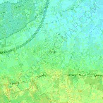
Name: Schaijk topographic map, elevation, terrain.
Location: Schaijk, Maashorst, Nordbrabant, Niederlande, 5374, Niederlande (51.72635 5.61147 51.76635 5.65147)
Average elevation: 43 ft
Minimum elevation: 20 ft
Maximum elevation: 72 ft