Geolocate

Chinnar topographic map

Click on the map to display elevation.

About this map

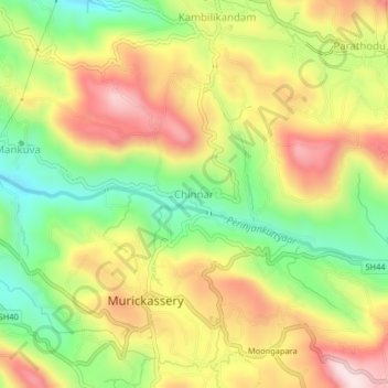
Name: Chinnar topographic map, elevation, terrain.

Location: Chinnar, Kerala, 685604, India (9.90422 76.99336 9.94422 77.03336)

Average elevation: 2,198 ft

Minimum elevation: 1,503 ft

Maximum elevation: 2,930 ft

Gear up for your next adventure:

🛠️Outdoor Gear Repair Kit - Essential tools to fix gear on the trail
🪶Wildlife Field Guides - Learn animal tracking and species ID
🦶Hiking Gaiters - Keep debris and water out of your boots
🔌Solar Panel Charger - Charge gear sustainably outdoors
👖Convertible Hiking Pants - Versatile zip-off pants for changing altitudes and temperatures

As an Amazon Associate, this site earns from qualifying purchases at no extra cost to you.