
Garampani topographic map
Interactive map
Click on the map to display elevation.
About this map
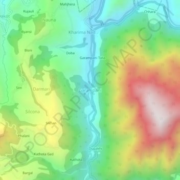
Name: Garampani topographic map, elevation, terrain.
Location: Garampani, Nainital, Uttarakhand, India (29.46181 79.45785 29.50181 79.49785)
Average elevation: 4,236 ft
Minimum elevation: 2,894 ft
Maximum elevation: 6,381 ft