
خنداب topographic map
Interactive map
Click on the map to display elevation.
About this map
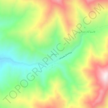
Name: خنداب topographic map, elevation, terrain.
Location: خنداب, بخش مرکزی, Asadabad County, Hamadan Province, Iran (34.74300 48.18616 34.78300 48.22616)
Average elevation: 6,860 ft
Minimum elevation: 5,784 ft
Maximum elevation: 8,258 ft
Other topographic maps
Click on a map to view its topography, its elevation and its terrain.
Asadabad
Iran > Hamadan Province > Asadabad County > دهستان سیدجمال الدین
Asadabad, دهستان سیدجمال الدین, بخش مرکزی, Asadabad County, Hamadan Province, 65416-48589, Iran
Average elevation: 5,509 ft