
Llanbister topographic map
Interactive map
Click on the map to display elevation.
About this map
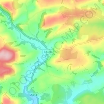
Name: Llanbister topographic map, elevation, terrain.
Location: Llanbister, Powys, Wales, LD1 6TN, United Kingdom (52.33157 -3.32897 52.37157 -3.28897)
Average elevation: 1,056 ft
Minimum elevation: 820 ft
Maximum elevation: 1,421 ft