
Teutschenthal topographic map
Interactive map
Click on the map to display elevation.
About this map
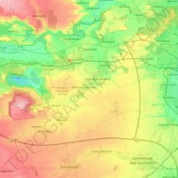
Name: Teutschenthal topographic map, elevation, terrain.
Location: Teutschenthal, Saalekreis, Saxe-Anhalt, 06179, Allemagne (51.39009 11.70510 51.49795 11.93114)
Average elevation: 417 ft
Minimum elevation: 164 ft
Maximum elevation: 699 ft