
Praia topographic map
Interactive map
Click on the map to display elevation.
About this map
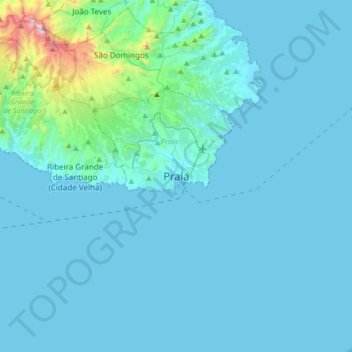
Name: Praia topographic map, elevation, terrain.
Location: Praia, Platô, Praia, 7600, Cape Verde (14.75628 -23.66951 15.07628 -23.34951)
Average elevation: 308 ft
Minimum elevation: -7 ft
Maximum elevation: 4,314 ft
Other topographic maps
Click on a map to view its topography, its elevation and its terrain.
Ponta de São Francisco
Cape Verde > Praia > Ponta de São Francisco
Ponta de São Francisco, Praia, Cape Verde
Average elevation: 449 ft